A 14-story mixed-use tower went up on Milwaukee Avenue last year. The shoring wall moved 0.4 inches after a heavy November rain. Nobody panicked—because the inclinometers caught it at 0.2 inches and the crew tightened the tiebacks before the next shift. That’s what monitoring does. Milwaukee’s lake-effect precipitation and shallow groundwater turn a routine dig into a moving target. We install automated total stations, load cells, and vibrating wire piezometers, then stream readings to the superintendent’s phone. When you’re cutting 35 feet into compressible clay near the Menomonee Valley, you don’t wait for a weekly report. You need thresholds and alarms. We also pull in-situ permeability data when dewatering volumes spike, because what’s happening at the excavation face usually starts in the soil 20 feet back. For deep soldier pile walls in tight urban lots, verifying liquefaction susceptibility below the bottom of excavation keeps the design honest when the fill layer runs deeper than the borings showed.
Monitoring doesn't prevent movement—it tells you the movement happened before your eyes see it. In Milwaukee's saturated clays, that time window is the difference between a minor adjustment and a street closure.
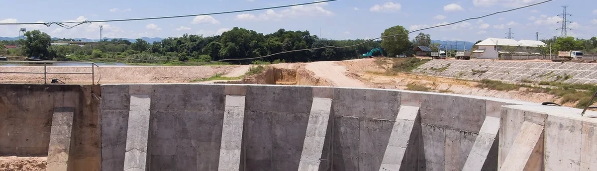
Local geotechnical context
Milwaukee’s downtown didn’t grow on rock—it grew on filled marsh and river sediment. The Third Ward and much of the central business district sit on 15 to 40 feet of compressible organic silt over dense glacial till. Every deep excavation here cuts through that transition zone, where lateral earth pressures shift unpredictably and dewatering pulls fines out of the formation. We’ve tracked inclinometer deflections that doubled in 48 hours when a thunderstorm overloaded the storm sewer and saturated the backfill behind the wall. In one case near the Milwaukee River, a sheet-pile wall rotated 1.2 inches at the top because the contractor underestimated the surcharge from a neighboring grain elevator built in 1922. Monitoring caught the trend early, the wall was rebraced, and the project stayed on schedule. Without real-time instrumentation, that same movement would have been discovered as a 3-inch crack in the adjacent parking ramp and a stop-work order. The IBC requires monitoring when excavations exceed 20 feet or when adjacent structures are within the zone of influence; Milwaukee’s soil profile often triggers that requirement even on shallower cuts because the risk of settlement-induced damage to century-old brick buildings is simply too high to accept without verification.
Quick answers
When does Milwaukee’s building department require excavation monitoring?
The city follows IBC Chapter 33, which triggers monitoring when the excavation exceeds 20 feet in depth, or when the zone of influence extends beneath an adjacent structure. In practice, most projects in the Third Ward, Walker’s Point, or near the lakeshore require instrumentation because the soil profile includes thick compressible layers. The plan must be sealed by a licensed professional engineer and submitted with the shoring permit package.
What’s the cost range for a typical Milwaukee monitoring setup?
For a standard 6-month monitoring program on a mid-rise excavation with 4 inclinometers, 8 load cells, and an automated total station, the fee runs between US$850 and US$2,570 per month. The total depends on the number of instruments, site access difficulty, and reporting frequency. We provide a fixed-price proposal after reviewing the shoring plans and the pre-construction condition survey of adjacent properties.
How quickly can you get instrumentation installed once excavation starts?
Inclinometer casing goes into the borehole the same day the soldier pile or secant wall is completed; we usually have the first baseline reading within 24 hours of grouting. Surface settlement markers and crack gauges can be installed before the excavator breaks ground. The automated total station requires a stable reference monument, which we establish during site mobilization. Full system commissioning typically takes three working days.
What happens if the monitoring system records a trigger-level movement?
The field engineer receives an automated alert by text and email the moment any instrument exceeds the preset yellow or red threshold. We call the superintendent within 15 minutes to confirm the reading isn’t an artifact. If the movement is real, we recommend immediate steps—usually tightening tiebacks, adding a strut level, or adjusting the dewatering rate. The data is time-stamped and documented for the engineer of record to review and revise the shoring design if needed.