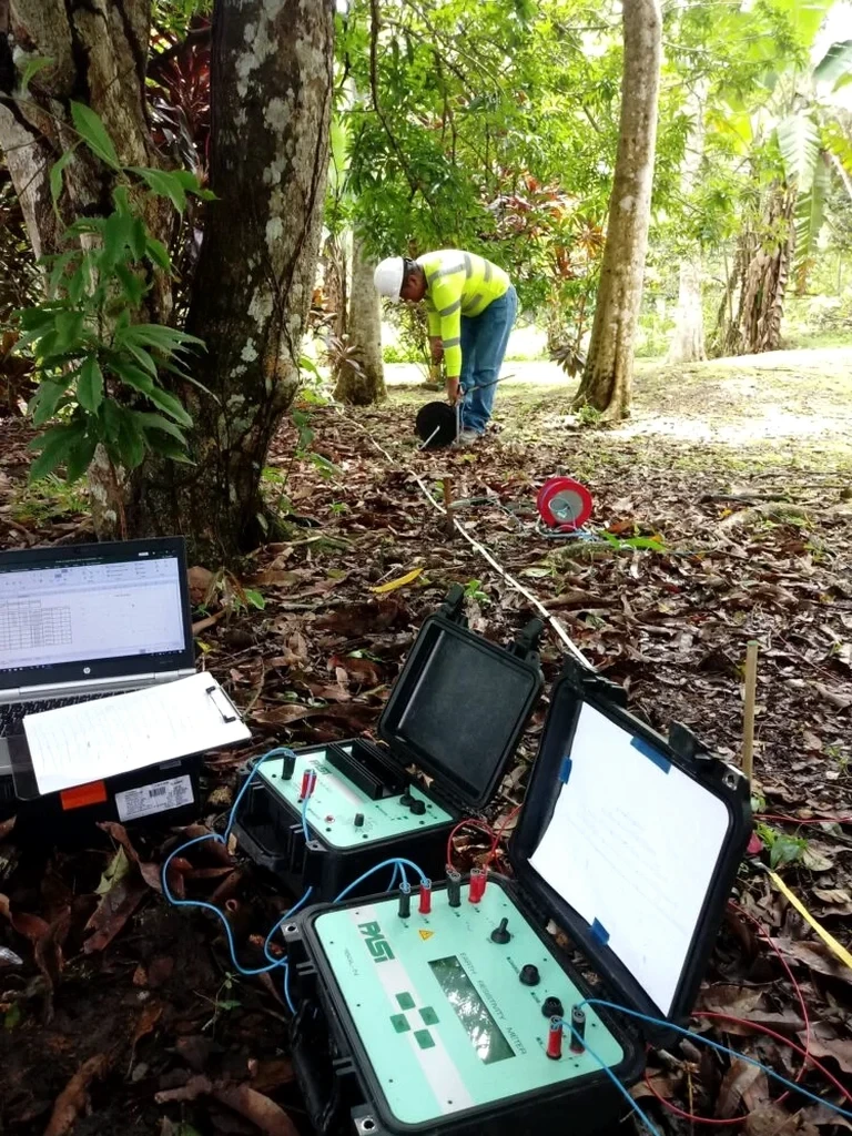
Milwaukee’s subsurface is a mixed bag. Glacial till over Silurian dolomite, buried river channels near the Menomonee Valley, lake-effect clays along the shore. You can’t assume uniform stratigraphy from one lot to the next. We run electrical resistivity surveys here because drilling alone misses lateral transitions that matter for foundation design or environmental delineation. A CPT test gives you point data, but resistivity profiles show the bigger picture between boreholes. When a site sits over the Niagara Escarpment bedrock or an old filled-in ravine, we need to map the contact without punching twenty borings. That’s where Vertical Electrical Sounding earns its place in your site investigation budget.
Resistivity doesn’t replace drilling in Milwaukee—it tells you where to drill and what the geology is doing between the boreholes.
Local geotechnical context
A warehouse redevelopment on fill along the Kinnickinnic River ran into trouble. Geoprobe refusal at 15 feet in spots suggested shallow rock, but it turned out to be boulders in glacial till, not continuous dolomite. They drove deep foundations everywhere, overspending by six figures. A resistivity line before the drilling campaign would have shown the till-bedrock interface dipping west under the site, not a uniform refusal surface. Misreading refusal as bedrock is a classic Milwaukee problem. On contaminated sites, skipping resistivity means your monitoring well network might straddle a plume boundary without actually capturing it. That’s six months of wasted quarterly sampling before anyone notices the concentration trend doesn’t make sense.
Quick answers
What does a resistivity survey cost for a typical Milwaukee site?
For a standard 2D line or a VES sounding at one location, budget between US$640 and US$1,090 depending on depth, array length, and site access conditions.
Can resistivity tell the difference between dolomite and shale in Milwaukee?
Yes, usually. Silurian dolomite has high resistivity, while the Maquoketa shale below it is conductive. The contrast is clear in most profiles, but we always ground-truth with at least one borehole.
How does frozen ground affect the survey?
Frozen surface soil increases contact resistance at the electrodes. We pre-wet electrode positions with saltwater to keep resistance low enough for good data quality during winter months.
How deep can you see with VES?
Maximum depth is roughly AB/3, so with a 500-foot current electrode spread we reach about 150 to 170 feet. Deeper targets need longer spreads or a different array geometry.
Do you combine resistivity with other methods?
Yes, often. Resistivity plus MASW gives us both conductivity and stiffness profiles. Adding CPT or SPT boreholes provides calibration points so the geophysical interpretation matches real soil behavior.